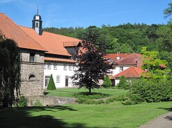
Hunnesrück Castle
Dassel
Access
No visits on recordNo opening hours or ticketing found
- Where
- Dassel
To make a day of it
Burg Hunnesrück stands in Dassel (Landkreis Northeim), in Lower Saxony, Germany. The building is a listed Baudenkmal. Recorded dating: 14th century. No visits are on record for this building.
Hunnesrück Castle is a ruined hilltop fortress in the Amtsberge hills north of Dassel, in Lower Saxony. Built in the 13th century by the counts of Dassel on a rocky spur of Muschelkalk limestone, it stood in such a commanding position that it was considered unassailable before the age of gunpowder artillery. What remains today are stretches of wall, ditches and earthworks that still trace the outline of a sprawling 180 by 90 metre complex. From the site there are also views over the Dasseler Börde and, further off, toward the Harz mountains.
What to know
- This is an open-air ruin, with no enclosed building or indoor exhibition.
- Access is via an uphill forest track through the Amtsberge hills, so sturdy footwear is advisable.
- The site is listed as a Baudenkmal in Lower Saxony.
- No verified information on opening hours or admission fees is available.
- The ruin suits a stop along a woodland walk more than an organised guided tour.
Where this château is
Dassel · Landkreis Northeim · Niedersachsen
Loading the map…
This châteauChâteaux within 40 km
Address
Gestütstraße, 37586 Dassel-Hunnesrück
Directions open from wherever you are, by car or public transport.
- Heritage status
- Baudenkmal in Niedersachsen
- Period of construction
- 14th century
Base map © IGN, Géoplateforme
In pictures
Frequently asked
- Where is Hunnesrück Castle located?
- It stands in the Amtsberge hills north of Dassel, in the Landkreis Northeim, Lower Saxony.
- When was Hunnesrück Castle built?
- It was built in the 13th century, probably in the 1270s, by the counts of Dassel.
- Why is Hunnesrück Castle a ruin?
- It was captured and destroyed in 1521 during the Hildesheim Diocesan Feud, after being bombarded from the nearby Hatop hill.
- What can still be seen at the site today?
- Remnants of walls, ditches and earthworks tracing the outline of the former stronghold, along with views over the surrounding landscape.
Something wrong here?
Tell us. Every report moves this entry up our verification queue.
Sources
Identity, location and official references from Wikidata and the Land's heritage lists.