
Cultural heritage D-3-7140-0037 in Sünching
Sünching
Visit
Hours to be confirmed
You are leaving for the château’s own website
- Where
- Sünching
Hours and prices not verified at the source yet.Check on the official website
To make a day of it
Bodendenkmal in Sünching, #D-3-7140-0037 stands in Sünching (Landkreis Regensburg), in Bavaria, Germany. Its opening hours and prices have not been verified at the source yet.
The Turmhügel Hardt is an archaeological remnant located about one kilometer southeast of Sünching, near the hamlet of Haidenkofen. It consists of the remains of a medieval tower mound, now partly overbuilt by the state road 2111. A circular earthen bank roughly fifteen meters in diameter is still visible, hollowed at its center, likely the result of past stone robbing. Locally the site is known as the "Römerschanze", even though it actually dates from the medieval period rather than Roman times.
What to know
- This is not a castle open for visits but an earthwork remnant, with no standing structure.
- Much of the site has been overbuilt by a road and now appears only as a circular embankment in the landscape.
- No precise dating exists beyond a broad estimate placing it in the High or Late Middle Ages.
- There are no known opening hours, fees, or visitor facilities associated with the site.
- Visiting amounts to observing the terrain feature, with no signage or infrastructure reported.
Where this château is
Sünching · Landkreis Regensburg · Bayern
Loading the map…
This châteauChâteaux within 40 km
Address
93104
Directions open from wherever you are, by car or public transport.
- Heritage status
- Protection status unknown
Base map © IGN, Géoplateforme
In pictures
Frequently asked
- Can you visit the Turmhügel Hardt?
- There is no organized visit; it is an earthwork feature that can only be viewed from outside, with no preserved building.
- How old is the Turmhügel Hardt?
- It is broadly dated to the High or Late Middle Ages, without precise confirmation from excavation or written sources.
- Why is the site called "Römerschanze"?
- This is a misleading local name, since the site actually dates from the medieval period rather than Roman times.
- Where exactly is the Turmhügel Hardt located?
- It lies about one kilometer southeast of Sünching, near the hamlet of Haidenkofen, in the Regensburg district of Bavaria.
- What remains visible of the site today?
- A circular earthen bank roughly fifteen meters across, hollowed at its center, with the rest overbuilt by a road.
Something wrong here?
Tell us. Every report moves this entry up our verification queue.
Sources
Identity, location and official references from Wikidata and the Land's heritage lists.
Within an hour’s drive
 Haidenkofen CastleSünching · Landkreis Regensburg
 Schloss Sünching (Sünching Castle)Sünching · Landkreis Regensburg
- Cultural heritage D-2-7140-0021 in GeiselhöringGeiselhöring · Landkreis Straubing-Bogen
- Cultural heritage D-2-7140-0184 in PerkamPerkam · Landkreis Straubing-Bogen
 Schloss Schönach (Schönach Castle)Mötzing · Landkreis Regensburg
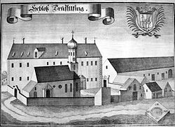 Schloss Triftlfing (Triftlfing Castle)Aufhausen · Landkreis Regensburg


