
Ringkopf
Sensweiler
Access
No visits on recordNo opening hours or ticketing found
- Where
- Sensweiler
To make a day of it
Open within 20 km
Ringkopf stands in Sensweiler (Landkreis Birkenfeld), in Rhineland-Palatinate, Germany. No visits are on record for this building.
The Ringkopf is a former circular rampart of Celtic origin, built around 520 BC on a quartzite ridge of the Hochwald in Rhineland-Palatinate. The roughly one-hectare triangular plateau still shows the outline of its collapsed enclosing wall and a long fortified approach path. Excavations carried out in 1935 and 1936 yielded little material evidence, suggesting that the site was not a seat of local power like some other ring forts in the region, but rather a place used only occasionally. Visitors today come as much for the forest walk as for the archaeology, since a themed trail dedicated to Celtic and Roman remains of the Hunsrück passes through the site.
What to know
- The site is reached on foot from Allenbach via a well marked forest path of about 3.7 km.
- There are no buildings or reconstructions on site, only the visible traces of the collapsed rampart and the fortified approach path.
- The route follows the Sirona themed trail, dedicated to Celtic and Roman remains of the Hunsrück region.
- The visit takes place outdoors on forest terrain, so sturdy walking shoes are recommended.
- There are no opening hours or admission fees, as the site is freely accessible year round.
Where this château is
Sensweiler · Landkreis Birkenfeld · Rheinland-Pfalz
Loading the map…
This châteauChâteaux within 40 km
Address
55758 Sensweiler
Directions open from wherever you are, by car or public transport.
5.0 / 5from 9 Google reviews
- Heritage status
- Protection status unknown
Base map © IGN, Géoplateforme
In pictures
Frequently asked
- What is the Ringkopf?
- It is a former circular rampart of Celtic origin, dating to around 520 BC, located on a hilltop of the Hochwald in Rhineland-Palatinate.
- How do you get to the Ringkopf?
- It is reached on foot from Allenbach via a marked forest path about 3.7 km long.
- Are there visible remains on site?
- Yes, the outline of the collapsed enclosing wall and the fortified approach path can still be seen on the roughly one-hectare triangular plateau.
- Was the Ringkopf an important Celtic power center?
- Since excavations in 1935 and 1936 yielded little material evidence, researchers believe it was used only occasionally, unlike some other ring forts in the region.
- Is there an entry fee?
- No fees or opening hours apply, as the site is freely accessible in the open countryside.
Something wrong here?
Tell us. Every report moves this entry up our verification queue.
Sources
Identity, location and official references from Wikidata and the Land's heritage lists.
Within an hour’s drive
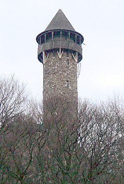 Wildenburg CastleKempfeld · Landkreis Birkenfeld
 Burg Baldenau (Baldenau Castle)Hundheim · Landkreis Bernkastel-Wittlich
 Castle ObersteinIdar-Oberstein · Landkreis Birkenfeld
 Burg Bosselstein (Bosselstein Castle)Idar-Oberstein · Landkreis Birkenfeld
 Burg Frauenburg (Frauenburg Castle)Frauenberg · Landkreis Birkenfeld
 Neues Schloss BirkenfeldBirkenfeld · Landkreis Birkenfeld
