
Cultural heritage D-2-7142-0301 in Straßkirchen
Straßkirchen
Visit
Hours to be confirmed
You are leaving for the château’s own website
- Where
- Straßkirchen
Hours and prices not verified at the source yet.Check on the official website
To make a day of it
Bodendenkmal in Straßkirchen, #D-2-7142-0301 stands in Straßkirchen (Landkreis Straubing-Bogen), in Bavaria, Germany. Its opening hours and prices have not been verified at the source yet.
This site marks the remains of a medieval motte, now vanished, which once stood near Straßkirchen in Bavaria. Nothing rises above ground anymore: the circular mound surrounded by a water-filled ditch, once visible on the old land survey maps, has since been levelled. Only differences in vegetation still hint, in places, at the former ring ditch's course. The ground is now largely built over by a farmstead.
What to know
- No above-ground structure remains; only the terrain's shape and vegetation may still hint at the former site.
- The location lies on private land, immediately next to a farmstead, and is not set up for organised visits.
- There are no opening hours, fees or visitor facilities at this site.
- Those interested in medieval archaeology may spot the former ditch's outline through vegetation differences on the eastern side.
Where this château is
Straßkirchen · Landkreis Straubing-Bogen · Bayern
Loading the map…
This châteauChâteaux within 40 km
Address
94342
Directions open from wherever you are, by car or public transport.
- Heritage status
- Protection status unknown
Base map © IGN, Géoplateforme
In pictures
Frequently asked
- Can the remains of the Straßkirchen motte still be seen today?
- No, the site has been completely levelled and shows no visible structure above ground, aside from possible traces in the vegetation.
- Where exactly was this fortification located?
- It stood about 650 metres south-southwest of the parish church of St. Stephen in Straßkirchen, just north of the Irlbach stream.
- How old is this structure?
- It dates from the late medieval period and early modern era, though a precise date is not established.
- Is the site open to visitors?
- The land, now largely covered by a farmstead, is not set up for public visits.
Something wrong here?
Tell us. Every report moves this entry up our verification queue.
Sources
Identity, location and official references from Wikidata and the Land's heritage lists.
Within an hour’s drive
 Schloss Schambach (Schambach Castle)Straßkirchen · Landkreis Straubing-Bogen
- Schloss Moosdorf (Moosdorf Castle)Aiterhofen · Landkreis Straubing-Bogen
- Cultural heritage D-2-7142-0138 in Bogen (Stadt)Bogen · Landkreis Straubing-Bogen
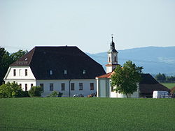 Hienhart CastleOberschneiding · Landkreis Straubing-Bogen
 Schloss Einhausen (Einhausen Castle)Atting · Landkreis Straubing-Bogen
 Schloss, sogenanntes PandurenschlösslStraubing · Straubing


