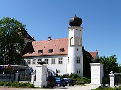
Cultural heritage D-2-7640-0009 in Bodenkirchen
Bodenkirchen
Visit
Hours to be confirmed
You are leaving for the château’s own website
- Where
- Bodenkirchen
Hours and prices not verified at the source yet.Check on the official website
To make a day of it
Bodendenkmal in Bodenkirchen, #D-2-7640-0009 stands in Bodenkirchen (Landkreis Landshut), in Bavaria, Germany. Its opening hours and prices have not been verified at the source yet.
At Haunzenbergersöll, a hamlet belonging to Bodenkirchen in Bavaria, once stood a manorial castle that no longer exists. The site, protected as an archaeological heritage monument, preserves underground traces of a medieval stronghold and its outbuildings, along with a ring shaped pond still visible today. The building itself, a two storey wooden structure depicted in a 1726 engraving by Michael Wening, was demolished in 1810 after falling gradually into disrepair.
What to know
- No visible structure of the castle survives, only the ring shaped pond still marks its former location.
- The site is an archaeological heritage monument, meaning buried remains rather than a visitable building.
- There are no opening hours, fees, or organized public access.
- The location lies near the parish church of St John the Baptist in Haunzenbergersöll.
Where this château is
Bodenkirchen · Landkreis Landshut · Bayern
Loading the map…
This châteauChâteaux within 40 km
Address
84155
Directions open from wherever you are, by car or public transport.
- Heritage status
- Protection status unknown
Base map © IGN, Géoplateforme
In pictures
Frequently asked
- Can you visit Schloss Haunzenbergersöll?
- No, the building was demolished in 1810 and only protected archaeological remains survive underground.
- What remains of the castle today?
- Mainly the ring shaped pond that once surrounded the building, along with buried traces of its foundations.
- Who owned this castle?
- The manorial estate belonged successively to the Hautzenperger, Tabertshofer, and Neuhaus families, later passing to the counts of Wahl.
- What did the castle look like before it was destroyed?
- According to an engraving from 1726, it was a two storey wooden building with a gabled roof, surrounded by a pond crossed by a wooden bridge.
Something wrong here?
Tell us. Every report moves this entry up our verification queue.
Sources
Identity, location and official references from Wikidata and the Land's heritage lists.
Within an hour’s drive
 Cultural heritage D-2-7640-0020 in WurmshamWurmsham · Landkreis Landshut
- Cultural heritage D-2-7540-0015 in BodenkirchenBodenkirchen · Landkreis Landshut
 Cultural heritage D-2-7639-0044 in Velden (Vils)Velden · Landkreis Landshut
 Cultural heritage D-1-7640-0088 in OberbergkirchenOberbergkirchen · Landkreis Mühldorf am Inn
 Schloss Egglkofen (Egglkofen Castle)Egglkofen · Landkreis Mühldorf am Inn
- Cultural heritage D-2-7540-0189 in BodenkirchenBodenkirchen · Landkreis Landshut