
Cultural heritage D-3-6538-0037 in Schmidgaden
Schmidgaden
Visit
Hours to be confirmed
You are leaving for the château’s own website
- Where
- Schmidgaden
Hours and prices not verified at the source yet.Check on the official website
To make a day of it
Open within 20 km
Bodendenkmal in Schmidgaden, #D-3-6538-0037 stands in Schmidgaden (Landkreis Schwandorf), in Bavaria, Germany. Its opening hours and prices have not been verified at the source yet.
This site marks the location of a former medieval motte, now vanished, known as the Turmhügel Schmidgaden. The early Bavarian cadastral map of around 1830 still showed an almost circular enclosure some 40 metres across, surrounded by an outer bank, standing apart from the village. The area has since been built over with a modern structure, and no remains can be seen today.
What to know
- This is not a visitable castle but a vanished archaeological site, now built over.
- No remains are visible on site, as the area is now an ordinary built plot in Schmidgaden.
- The site is listed as a Bodendenkmal under reference number D-3-6538-0037.
- No century, opening hours or admission fees are available, since there is nothing left to visit.
Where this château is
Schmidgaden · Landkreis Schwandorf · Bayern
Loading the map…
This châteauChâteaux within 40 km
Address
92546
Directions open from wherever you are, by car or public transport.
- Heritage status
- Protection status unknown
Base map © IGN, Géoplateforme
In pictures
Frequently asked
- Can you visit the Turmhügel Schmidgaden?
- No, the site has vanished and the location is now covered by a modern building.
- What remains to be seen there?
- Nothing is visible today, the former motte has been completely built over.
- Where was this motte located?
- It stood in Schmidgaden, in the Landkreis Schwandorf, Bavaria, at what is now the Schulstraße.
- How large was the original enclosure?
- Early 19th century cadastral maps show an almost circular enclosure about 40 metres across, surrounded by an outer bank.
Something wrong here?
Tell us. Every report moves this entry up our verification queue.
Sources
Identity, location and official references from Wikidata and the Land's heritage lists.
Within an hour’s drive
 Schloss Schwarzenfeld (Schwarzenfeld Castle)Schwarzenfeld · Landkreis Schwandorf
 Cultural heritage D-3-6539-0152 in NabburgNabburg · Landkreis Schwandorf
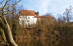 Schloss Fronberg (Fronberg Castle)Schwandorf · Landkreis Schwandorf
 Burg Freudenberg (Freudenberg Castle)Freudenberg · Landkreis Amberg-Sulzbach
- Cultural heritage D-3-6539-0145 in NabburgNabburg · Landkreis Schwandorf
 Burgruine EberburgEbermannsdorf · Landkreis Amberg-Sulzbach


